THE THEMEShortly after 4.30 in the morning of Saturday, 4th September 2010, an earthquake of magnitude 7.1 on the Richter scale shocked the population of the province of Canterbury into wakefulness. It was centred close to the mid-Canterbury town of Darfield, completely destroying a few historic homesteads in the region, and caused significant damage to Christchurch city itself, but no fatalities resulted.
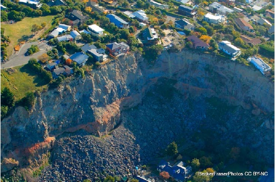
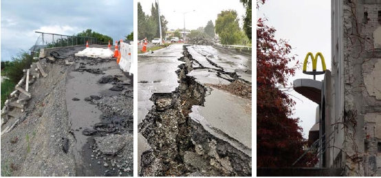
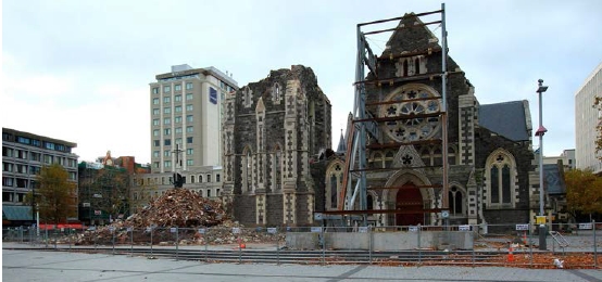
Cantabrians were yet to learn that this was but a taste of worse to come. Six months later, Canterbrians again experienced the earth move under their feet, and this time it was a deadly event. The second major earthquake struck on a sunny Tuesday lunch hour at 12.51 local time on 22nd February 2011. This earthquake, on a different fault line, was centred two kilometres west of the port town of Lyttelton, and 10 kilometres south-east of the centre of Christchurch, New Zealand’s second-most populous city. A total of 182 people were killed on that day in Christchurch, making it the second-deadliest natural disaster recorded in New Zealand (after the 1931 Hawke’s Bay earthquake), and fourth-deadliest disaster of any kind recorded in New Zealand, with nationals from more than 20 countries among the victims. Many structures in the city’s CBD and eastern suburbs that were weakened by the September earthquake and its ongoing aftershocks were destroyed in February’s disaster or subsequently judged uneconomic to repair. The earthquake effectively shut down the city’s central business district, which alone has lost almost 1,000 buildings. Significant liquefaction again inundated the eastern suburbs, producing about 400,000 tonnes of silt. The 22 February earthquake was one of three major
earthquakes in a swarm affecting the Christchurch area that, to date,
has lasted more than a year. The Christchurch City Council’s draft Central City Plan for the recovery of the Christchurch central business district was released in August 2011 and details more than 70 projects, including 10 key projects, to be implemented over the next 10 to 20 years. Many of these projects have been influenced by more than 100,000 ideas shared by the community and key stakeholders during the plan submission process. In spite of the disastrous swarm of quakes, Christchurch remains fully functional and repairs to essential service infrastructure have largely been completed. Although major business is not currently based in the heart of the city, a central retail precinct is already open, with more hospitality facilities opening weekly. Suburbs, particularly those to the north, south and west, are experiencing a boom and visitor attractions out of the city centre are unaffected. People of Christchurch have always had a pioneering instinct and they have thrown themselves wholeheartedly into the consultation process and a new vision for their city.
|
Sendai Framework for Disaster Risk Reduction 2015-2030
The Sendai Framework for Disaster Risk Reduction 2015-2030 was adopted by UN Member States on 18 March 2015 at the Third UN World Conference on Disaster Risk Reduction in Sendai City, Miyagi Prefecture, Japan. The Sendai Framework is the first major agreement of the post-2015 development agenda, with seven targets and four priorities for action.
FIG Publication no. 38
The Contribution of the Surveying Profession to
Disaster
Risk Management
FIG Publication no. 65
The Surveyor's Role
in Mitigating and Adapting to Climate Change.