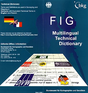
FIG Multilingual Technical Dictionary
Already in 1971 a Dictionary for the surveyors' environment was published:
Some things never change but some things have changed rapidly. Progress in science and technology made it necessary to revise the Preliminary Edition. This huge work started between 1984 and 1990. The result is something to rely on: Terms selected by competent technical committees, defined by competent specialists, English and French terms checked by competent native speakers. FIG Multilingual DictionaryThe following organisations stand for the quality of the Dictionary:
They created the FIG Multilingual Dictionary Each volume of the Dictionary contains
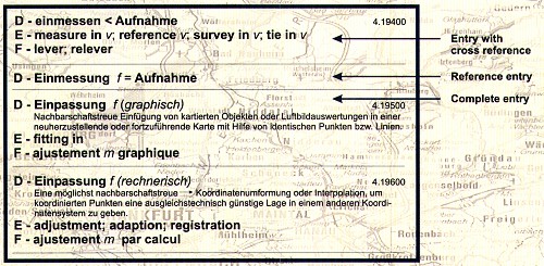
How does the Dictionary look like?
What's new?
Already published as revised editionVolume 3: Geodetic Surveying Volume 4: Cadastral Surveying and Cadastre Volume 5: Geodetic Instruments Volume 6: Topography Volume 10: Engineering Surveying Volume 11: Hydrographic Surveying Volume 12: Mine Surveying Volume 13: Property Valuation Volume 14: Land Consolidation Volume 15: Urban Planning, Regional Policy Prices plus post and package! The following volumes are in preparationVolume 1: Theory of errors, adjustment methods and mathematical statistics Volume 2: Geodesy Volume 7: Photogrammetry Volume 8: Cartography Volume 17: General Terms Technical DictionaryTerms and Definitions as used in Surveying and Mapping in Germany with Equivalent Technical Terms in English and French Editorial Office / InformationCentral Office for GeotopographyFederal Agency for Cartography and Geodesy Bundesamt für Kartographie und Geodäsie Leipzig, Germany Email: dlz@bkg.bund.de FIG Office 14 July 2001. Revised 2 February 2026 |
|||||||
|
|
|||||||