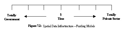
IT Developments Enabling Customer-Oriented CadastreBogdan Ney and Andrzej Sambura, PolandThis paper was first presented at the 2nd Cadastral Congress, September 19-21, 2003 in Kraków, Poland 1. ROAD FROM PRODUCER-ORIENTED TO CUSTOMER-ORIENTED CADASTRE1.1 Current SituationThe current situation in cadastre is characterized by three main factors. Firstly, the cadastre and cadastral systems can be described as “producer-oriented”, ie. predominantly driven by the needs of “producers” being the public institutions responsible for cadastre. The majority of developments are directed towards improving internal processes of these institutions or simply replacing obsolete computer systems. The customers of public institutions are getting indirect benefits of improvements in functioning of these institutions through better customer service and faster turnaround, however it is only a fraction of vast potential for improvements. Examples of developments in land administration and registration directly driven by specific customer needs until very recently were rare to find. Secondly, the major use of cadastral data still occurs through embedding them in cadastral documents used in the conveyancing process or more generally in land administration and registration. Examples of such documents include surveyors’ property plans, cadastral maps or property sketches on the title document. New information products combining cadastral data with other types of data are not yet commonly available. Some of the reasons for this situation are discussed in this paper. Last but not least, cadastral and land registration services, with few notable exceptions, are the exclusive domain of public administration. Will it remain so or may be a move to a smaller and more efficient Government will create a pressure for the involvement of the private sector in that area? 1.2 New Trends and DevelopmentsFor those believing that cadastre should be “customer-oriented” and not “producer-oriented” there is a lot of hope in new trends and developments. These trends and developments in many countries point out without any doubt in “customer-oriented” direction. A new ‘breed’ of customers drives the most significant developments in the market place. The most important of these developments are in providing cadastral data and services over the Internet. A battle for the attention of the service providers between the ‘on-line’ versus ‘over-the-counter’ customers is being slowly won by the on-line customers. The services, being more and more often demanded by the on-line customers, include not only remote inquiry but also remote delivery of electronic version of cadastral documents used in the conveyancing process as well as remote lodgment of applications and other documents. Once these services are available, land administration and registration and conveyancing will not be the same. The on-line customers have already commenced to demand additional services such as a delivery of cadastral data in standard electronic format not embedded in cadastral documents. These services are enabling integration of cadastral data with other spatial data with the objective of creating information products to be used in many other applications such as emergency services or spatial planning. However, the Government agencies often cannot deliver these new services or do not want to deliver them. As a result, real revolution is brewing with tacit approval of, and sometimes even guided by Government authorities. The revolution is being inspired by the private sector stepping in to satisfy the demand. In some countries, the delivery of many information products and services, including cadastral services, has been already transferred from governmental into private hands. This is just the beginning of the involvement of the private sector in such services, as Grant and Williamson pointed out (Grant, Williamson, 2003). “… the future of spatial information use at a State level will find itself increasingly in the hands of the private sector. Gradually the information products will move from government to the private sector on the continuum shown in Figure 7.2. More outsourcing of both traditional government collection and maintenance of spatial information activities will occur…”
and more on the subject by the same authors: “… In this environment, value added resellers (VARs) should be encouraged to develop new products and services ... VARs fill a most valuable role in converting, aggregating, enhancing and marketing any and all of the spatial and aspatial information sets to the world. It is they who have most experience in the identification of market need…” But the involvement of private sector will not happen overnight. In many countries, Poland not excluding, transfer of the government functions into private hands is still an anathema to a large range of pressure groups, from civil servants through public service unions to conservatively minded surveyors and similarly minded associated professionals. 2. IT DEVELOPMENTSThere are many prerequisites for emergence of a true “customer-oriented” cadastre such as an appropriate set of Government policies (access, privacy, pricing etc.), institutional and legal framework and the necessary financial arrangements (fees, payment mechanisms, incentives etc.) to mention just the few most important. The real enabler of implementation of the concept of a “customer-oriented” cadastre is undoubtedly information technology (IT). As mentioned before, what distinguishes “customer-oriented” from “producer-oriented” cadastre is the customer demand for remote delivery and acceptance of electronic data, documents and services. Without the latest IT developments, which are identified and discussed further in this paper, it would not be possible to satisfy this demand. The most comprehensive analysis of recent IT developments in Europe relevant to cadastre is covered in the proceedings of FIG’s Commission 7 seminar on IT renewal strategy for land registry and cadastre (Enschede, 2003). This part of the paper discusses those IT developments which can be deemed essential for “customer-oriented” cadastre. 2.1 Spatial Data Infrastructure (SDI)There is no doubt that of all IT developments relevant to cadastre, the most important are those which form the IT foundation of spatial data infrastructures (SDI). One could say “what is good for SDI is good for cadastre”. In order to verify this statement the paper will analyze the major objectives of SDI and then the IT developments which can support fulfillment of those objectives. The most comprehensive and up todate formulation of critical objectives of any SDI has been developed within the EU’s project INSPIRE (INfrastructure for SPatial Information in Europe). These objectives are listed below:
Lets look more closely at those IT developments that may be consider necessary for the accomplishment of above listed objectives: 1. Data should be collected once and maintained at the level where this can be done most effectivelyThe enabler for this objective is predominantly of institutional or organizational character, namely it depends on the principle of nominating “data custodian” for each category of data, ie. institution or agency solely responsible for collection and maintenance of this data. The responsibilities for these functions are usually defined in a charter of the appropriate agency or in other legal regulations. Frequently, these responsibilities are prescribed on a territorial basis. In Poland for example, local government administration at a district level is responsible for cadastre data in its district. As a result, some categories of SDI data (eg. cadastral data) are already being collected once and maintained at the level where this can be done most effectively. However, it has to be remembered that implementation of the “data custodian” principle within the SDI framework depends on IT. Local databases at various levels, used for the collection and maintenance of the SDI data, have to become nodes in the SDI network for the SDI to function properly. Therefore, there is a requirement for an IT solution enabling interoperability of the SDI nodes. The interoperability means establishing standards for both, SDI data and services. 2. It should be possible to combine seamlessly spatial information from different sources across Europe and share it between many users and applicationThere is nearly universal consensus that IT solutions enabling seamless integration of spatial information from different sources eventually should be based on the interoperability standards applied to both data and services linking various data source systems. The data standards providing the necessary elements of the interoperability within Europe or across the world are usually based on a combination of the OGC and ISO specifications (eg. GML 3.0 for data transfer format and ISO/TC 211-19115 for metadata standard). Known examples of successful SDI interoperability through a combination of data standards and service standards are also based on the OGC specifications such as WFS (Web Feature Server) and WMS (Web Map Server) models of Web services. Using such services it is possible to extract automatically a defined subset of data from a given SDI node and send it to another SDI node in the form of a vector file in the GML 3.0 format or in the form of an image file, ie. in a GeoTIFF file. In the short to medium term however, IT solutions based solely on the interoperability standards may not be possible to implement due to limitations of many data custodian systems in the area of hardware, software or telecommunication. In such circumstances, the solution is an implementation of a concept of spatial data repositories (data warehouses). The repositories store replicas of source data maintained by the data custodian systems through transfer of update data in one of common data formats. These formats may be based on the OGC/ISO specifications and may also include other formats such as ESRI shape files or local CAD formats. Also the source systems may communicate with data repositories through files and not on the server to server basis. 3. It should be possible for information collected at one level to be shared between all the different levels, detailed for detailed investigations, general for strategic purposesThe SDI implementations currently being developed in various countries are based, nearly without exception, on a concept of a multi-level infrastructure of a network of co-operating SDI centres/nodes linked by Internet technology. The SDI nodes in the form of an Internet portal and/or data warehouse are usually elements of various levels of SDI: local, regional, national and even Pan-European. For example, databases at local level contain detailed information (eg. cadastral, utilities and zoning data), based on large scale datasets collected and maintained by the surveying and mapping authorities at that level. The regional SDI nodes contain general geographical information (eg. topographic maps, transportation networks and ecological information for regional planning purpose), based on medium to small scale datasets collected and maintained by the regional surveying and mapping authority. The IT solutions based on the interoperability standards and modern database technologies allow integration of various formats of data (text, graphics, images etc) within one database and permit data to be shared between the different levels and to be freely combined. The databases that allow such integration of data usually support object-oriented standard data models (eg. OGC’s Simple Features Specification for SQL). Using such a technology, it is already possible to combine the topographic, transportation and ecological information from the regional level with the land ownership and zoning information from the municipal level to conduct for example a highway feasibility study. 4. Geographic information needed for good governance at all levels should be abundant under conditions that do not refrain its extensive useSo far, the up-to-date spatial information in digital format that could be shared is limited. Additionally, there are obstacles that restrict its extensive use, eg. the restrictions on access to personal data and high fees for official surveying and mapping data. However, the same IT solutions helping to achieve previously discussed INSPIRE objectives should also improve the availability of geographic information. These IT solutions are based on a combination of the interoperability standards and spatial data repositories (data warehouses) accessed through Internet. Once we link all available data source (data custodian) systems to the SDI data warehouses, there will be a lot of data to improve the governance procedures and delivery of services to citizens. 5. It should be easy to discover which geographic information is available, fits the needs for a particular use and under which conditions it can be acquired and usedThe fundamental SDI mechanisms of data discovery utilize metadata and catalogue services complying with the OGC and ISO standards mentioned above. The user may traverse the distributed catalogue and metadata structures to search for the required data, and check if geographic information available in the SDI databases fits his requirements. The user may also extract selected data, combine it with data from other sources and manipulate within the standard Web browser environment. Information on conditions, under which the selected data can be acquired and used, including billing information should also be provided to the user by the same mechanisms. 6. Geographic data should become easy to understand and interpret because it can be visualized within the appropriate context selected in a user-friendly wayThe user interface model adopted by the majority of existing SDI implementations is based on a “data layer” paradigm, which is not only user-friendly but also facilitates easy understanding and interpretation of geographic data. The paradigm, used practically by all GIS packages as the main mechanism for visualization and interpretation of geographic data, is based on a concept of manipulating layers (categories) of data combined with the mechanisms of data discovery described above. Additionally, the GIS-based “data layer” model of the user interface is combined in the SDI environment with the WWW portal interface of a standard Internet browser. As a result, user works within a standard Web browser environment through a Java applet similar in appearance to a GIS desktop environment. Separation of operational databases from data access and delivery databases Separation of operational databases from decision support databases, ie. databases used in data access and analysis has been a norm in the world of business systems for many years. The separation of the corporate systems into two categories has been justified by different requirements regarding functions, accessibility, performance and security. The world of cadastral and land registry systems, usually based on large computer mainframes, has been much more conservative. Advent of distributed systems linked through wide area networks has forced re-thinking of the IT strategies as discussed by the countries presenting papers during seminar in Enschede (2003). With one notable exception, all the countries made decisions to separate their cadastral data collection and maintenance systems (data custodian systems) from the systems providing data and services to the end users. The resulting IT systems are better performing, with each of the systems being tailored to a different pattern of use and different functions. In addition the source data stored in the cadastral data collection and maintenance systems are separated from data being used for analysis and distribution. The systems are also much more flexible and easier to upgrade. Electronic documents and electronic signature Exchange of electronic documents authenticated by electronic signatures has been practiced between business partners or between banks and their customers for many years. The IT and telecommunication solutions have been in place even longer however the legal framework lagged behind. But by now, most of the OECD countries have appropriate legislation in place and the applications involving electronic documents and electronic signature are being spread in the business and banking world very fast indeed. The world of land administration and registration is lagging seriously behind the business world basically without any justification. However growing demand from the on-line cadastre and land registry users for remote secure delivery and lodgment of electronic version of cadastral documents (eg. in the conveyancing process) has changed the situation completely. Experiments with adding these kinds of functions to the existing systems are being conducted and the common availability of such services is expected within few years from now. The prerequisites for that happening are of organizational/legal and technical nature. Firstly the so-called PKI (public key infrastructure) for electronic signature must be in place. The term ‘PKI’ is related to a pair of private and public keys (being very large numbers) used for encryption of electronic signatures. One or more of CA (certification authorities) that constitute the PKI usually do certification of the keys for individual users after they generate their private and public keys using appropriate software with encryption algorithms (eg. RSA). After certification the public keys are usually registered on special “key servers” where anybody can get a public key of a person for verification of his/her signature. Summary of IT developments enabling “customer-oriented” cadastre The paper has described recent IT developments, which not only provide the technical tools for implementation of a true “customer-oriented” cadastre but are also necessary for the fulfillment of the user requirements. Even a couple of years ago it would be nearly impossible to provide cost-effectively the services currently demanded by the on-line users of cadastre. Now, the IT solutions summarized below, which are necessary for implementation of various on-line user requirements are commonly available. = remote access to combined complex cadastral information from cadastre and land registry This function has probably the most demanding requirements for IT solutions discussed so far. Other on-line users’ functional requirements need only a subset of IT solutions listed below:
= remote secure delivery of electronic version of cadastral documents used in the conveyancing process Implementation of this function requires only a subset of a full set of IT solutions listed above. It requires however a legal framework for using electronic documents signed by electronic signatures that have the same legal status as traditional signatures. Poland already has an appropriate law in place.
= remote secure lodgment of applications and other documents used in land administration and registration This function has similar requirements for IT solutions as the function of remote secure delivery of electronic version of cadastral documents (see above). = remote delivery of information products combining cadastral data with other spatial data in a standard electronic format Implementation of this function requires only slightly smaller set of IT solutions than for remote access to combined complex cadastral information described above.
3. BARRIERS TO IMPLEMENTATIONThe paper has so far identified some of the ‘drivers’ for development and implementation of a true “customer-oriented” cadastre and a set of ‘enablers’, mostly in the form of IT developments. However there also exists a set of ‘barriers’ to implementation. These barriers must be identified and gradually dismantled over time for the “customer-oriented” cadastre to become a reality. Before we move to identify and analyze the barriers, lets review the drivers as, in the authors’ opinion, they are intrinsically related feeding each other. The main on-line user requirements, discussed above, are recapitulated below:
Apart from these user requirements, there are other trends that support movement in the same direction of the “customer-oriented” cadastre. These other trends and developments are being driven by both the Government and the private sector. On the Government side, the main trends and developments are:
As a result, Government is shedding some of its services being considered as non-core business but for doing so it needs partners who would step in. These partners are coming from both non-governmental organizations (NGOs) and the private industry. And that leads to the main driver of developments on the private industry side:
All this will not eventuate without implementing the concept of sharing and partnership. Let’s again quote Grant and Williamson (2003) on this subject: “…There are other factors, which must be considered in the move along the continuum (…between government and private sector positioning - Figure 7.2…), and these factors start to create the concept of sharing and partnerships. Some of these factors are current political philosophy, bureaucratic will, private sector maturity and commercial entrepreneurship. Government policy must be able to demonstrate adequate access to data, a clear understanding of intellectual property rights, effective relationships between agencies and non-restrictive legislation. While there are others [solutions], for effective creation and delivery [of services], partnerships currently present the best opportunities…” It is interesting nonetheless to note that these forces driving Government and the private industry toward partnership are encountering counter-forces, usually within the same Government environment, which create ‘barriers’ to implementation of a “customer-oriented” cadastre. For example, the said above “current political philosophy and bureaucratic will” are espoused in the high circles of the Government but may not be shared or even may be sabotaged by the civil servants defending their local discrete fiefdoms. And the “private sector maturity and commercial entrepreneurship” may be rendered completely ineffective by a mutual mistrust between potential government and private sector partners. Then we have the issues of “intellectual property rights, effective relationships between agencies and non-restrictive legislation [eg. on data pricing]”. Resolving these issues, and hence removing the barriers require slow and gradual building of trust between partners. Nothing works better than examples of successful pilot schemes proving that partnership in building together various features and functions of a “customer-oriented” cadastre is possible and fruitful. 4. IN PLACE OF CONCLUSIONSThe authors, notwithstanding the existing barriers, are convinced that existing drivers and enablers of a true “customer-oriented” cadastre will prevail. Within 3-5 year period we will see in practice examples of a fully electronic conveyancing, including remote lodgment and delivery of electronic cadastral documents into the hands of citizens. REFERENCESEnschede, 2003, International Seminar on IT renewal strategy for land registry and cadastre, FIG Commission 7, Enschede, the Netherlands, 8-9 May, 2003. Grant D., Williamson I. 2003, State SDI Initiatives, Chapter 7, Developing Spatial Data Infrastructures: from Concept to Reality, (London: Taylor & Francis). CONTACTProf. Bogdan Ney, Division Chairperson |