CHANGES IN THE DEFINITION OF PROPERTY: A CONSIDERATION FOR A 3D CADASTRAL REGISTRATION SYSTEMJantien STOTER and Jaap ZEVENBERGEN, The NetherlandsKey words: stratum rights, land registration, multiple land use, 3D registration. AbstractThe Dutch Land Registration Office (the Netherlands' Kadaster)
maintains the cadastre and registers the legal status of real estate
objects. To be able to do this, the objects (parcels) are digitally
stored and maintained in a spatial information system. Until now the
spatial information system that is used to register the legal status
of land is a two dimensional system: parcels are defined by 2D
juridical boundaries.
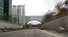
The current cadastral registration is based on the property relations in a column: the 2D parcel on the surface is the entrance for registration activities. Constructions under or above the surface are divided into parts that match with the parcels partitioning the surface. Establishing rights and limited rights on the parcels generates a horizontal division in the legal status of property. This means that the vertical dimension, which may be important, can not be reflected in the spatial information system and can therefore only be registered administratively (as an attribute of defined parcels). In the Netherlands, a 2D system to register the legal status of real estate objects is no longer sufficient in all cases. It is expected that the Netherlands' Kadaster will run into registration and maintenance complications in the future. For this reason, the Kadaster decided to carry out a research project on the 3D aspects of cadastral registration. The research project is carried out at the Department of Geodesy, Delft University of Technology in collaboration with the Netherlands' Kadaster. During this research the needs, possibilities and constraints to develop a 3D cadastre are examined. The research aims to develop a land information system, which can take into account the juridical relevant spatial information in the vertical dimension in case the situation requires this. It focuses on creating the possibility to define and represent real estate objects under and above the surface as an extension to the current cadastral registration system, which is based on defining and providing information on land in 2D (parcels). This paper contains an analysis of the background of the research project as well as the developed concept of a 3D cadastre. In addition, considerations for the implementation of this concept are described. BIOGRAPHICAL NOTEJantien Stoter is doing a Ph.D. on 3D cadastres, in which the needs, possibilities, and constraints for 3D cadastral registrations are studied. The emphasis of the research is the implementation of the possibility to incorporate 3D real estate objects (geo-objects) in the current geo-DBMS based on 2D parcels of the Netherlands' Kadaster. Jaap Zevenbergen is working in the field of geo information infrastructure in general and cadastral systems in particular with a main focus on juridical and administrative aspects. He has studied and advised on cadastral systems in many countries, in the last few years especially in Central Europe. CONTACTJ. E. (Jantien) Stoter Jaap Zevenbergen 24 March 2001 This page is maintained by the FIG Office. Last revised on 15-03-16. |