News in 2016

|
FIG Asia Pacific Capacity Development Network Report on
FIG / UN-GGIM-AP / JUPEM Geospatial and GNSS CORS Infrastructure and
Systems Forum
16 - 17 October 2016 , Kuala Lumpur, Malaysia

 Download report
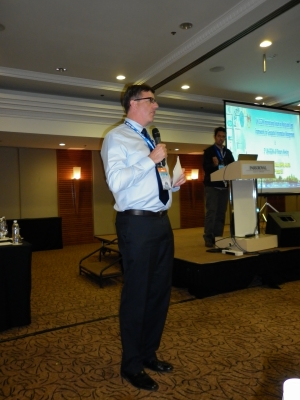
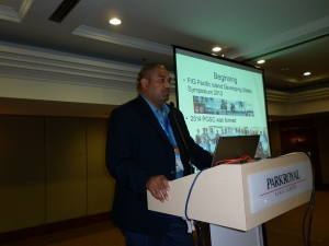
The Park Royal, Kuala Lumpur – Malaysia was the venue for the FIG,
UN-GGIM-AP Working Group 1 Geodetic Reference Frame, and JUPEM forum on
Geospatial and GNSS CORS Infrastructure and Systems. The forum was
convened on the 16 - 17 October 2016, and comprised of 6 sessions, and
22 presentations. Although this style of workshop was not the first of
its type in the Asia Pacific region, it was the first main gathering for
the recently formed FIG Asia Pacific Capacity Development Network (AP
CDN).
The impetus for this forum originated from discussions with several
Asian countries, Leica Geosystems representatives (namely Mr
Neil Ashcroft), UN-GGIM-AP Chair Dr. John Dawson
and Rob Sarib at the FIG Working Week in Christchurch.
Over the next few months the program evolved and the following
objectives relevant to geospatial data and GNSS CORS infrastructure
themes, such as standards, access to information, institutional
arrangements, legal / policy requirements, technology, communications,
data, capacity development, people and partnerships, were generated-
- to facilitate the exchange of information, knowledge and
experiences;
- to showcase the development of geospatial / geodetic
infrastructure
- to provide other countries in the region with the opportunity to
improve or modernise their infrastructure via a collaborative
environment of likeminded people; and
- to establish a regional geospatial / geodetic communication
network to discuss common challenges, and possible solutions.
The forum host Dr. Azhari bin Mohamed and the
national government agency JUPEM (Department of Survey and Mapping,
Malaysia) organised an outstanding venue, and provided additional staff
to support the logistical components of the forum. All aspects of the
venue, hospitality and service were professionally performed and enabled
a friendly and participatory environment.
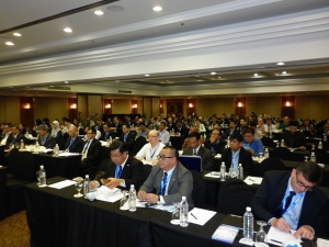
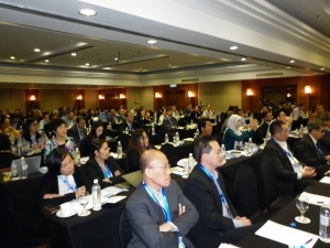
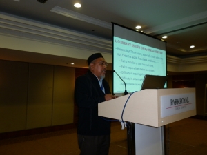
Over 150 delegates from 21 different countries registered for the
forum. Over the 2 days, the forum attracted over 100 participants
each day and these attendees actively engaged and contributed to the
program. To review and access all presentations listed in the
following sessions, please navigate to FIG Asia Pacific Capacity
Development Network
website.
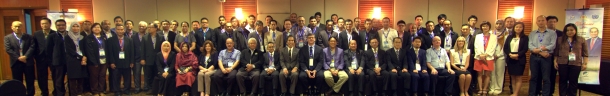
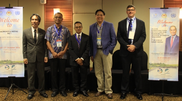
Group photo
Session - Status of Geospatial / Geodetic Infrastructure in
the Region
Outline: Invited countries provided a brief overview of their status
but more importantly shared insights into how their organisation
overcame their biggest challenge when developing and establishing
geodetic and geospatial infrastructure.
Presenters –
- MMs. Charisma Victoria Cayapan - Head PageNet
Group NAMRIA, Republic of the Philippines
- Mr. U Aung Moe - Director Geodetic Division,
Survey Dept., Republic of the Union of Myanmar
- Mr. Ali Bakar Kasim - A / Surveyor General
Ministry of Development, Brunei Darussalam
- Col. Chaiwat Promthong - Director Geodesy and
Geophysics Division Royal Thai Survey Dept., Thailand
- Mr. Kueh Hui Urg - Assistant Director
Survey Land and Survey Dept., Sarawak
- Dr. Antonius Bambang Wijanarko - Head of Centre
Geodetic Control Network and Geodynamìc Badan Informasi Geospasial,
Indonesia
- Mr Tatiya Chuentragun - Director
Geo-Informatics Product - Geo-Informatics and Space Technology
Development Agency, Thailand
- Mr Meas Bun Thoeun - Director Dept. of Cadastre
& Geography Ministry of Land Management, Urban Planning &
Construction, Cambodia
- Mrs. Do Thi Thu Thuy, Deputy Chief of Science
and International Cooperation Office Dept Surveying and Mapping,
Vietnam
Session - Why Geospatial / Geodetic Infrastructure?
Outline - This session focused on the fundamental purpose and why
countries need geospatial and geodetic infrastructure and information;
with particular emphasis on how such infrastructure can confront a
nation’s economic / political / social / technological challenges.
Presenters –
- Mr Greg Scott - Inter-Regional Advisor Global Geospatial
Information Management United Nations Statistics Division Department
of Economic and Social Affairs, United Nations
- Mr Andy Wilson - Ordnance Survey International, United Kingdom
- Mr Teo CheeHai – UN-GGIM Secretariat Global Geospatial
Information Management United Nations Statistics Division Department
of Economic and Social Affairs, United Nations
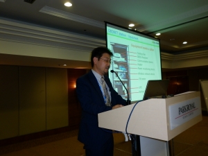
Session - Reference Frames and GNSS CORS
Outline - This session provided a technical overview on the
hierarchal structure of reference frames and the potential benefits for
participating agencies. This includes information on GGRF, ITRF,
National geodetic datum, and the importance of GNSS CORS.
Presenters –
- Dr John Dawson – UN-GGIM-AP WG1 Chair
- Mr Sohaime Rasidi - Director Geodetic Survey Division, JUPEM,
Malaysia
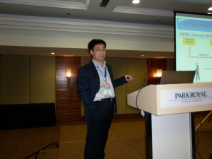
Session - Modernisation of Geospatial / Geodetic
Infrastructure
Outline – Case studies on the implementation of GNSS CORS to
modernise geospatial and geodetic infrastructure were presented. This
included information on challenges faced with respect to standards,
access to information, institutional arrangements, legal / policy
requirements, technology, communications, data, people and partnerships.
Presenters –
- Mr Basara Miyahara - Geospatial Information Authority of Japan,
Japan
- Prof. Dr. Yamin Dang - Director of the Institute of Geodesy and
Geodynamics, Chinese Academy of Surveying and Mapping, China
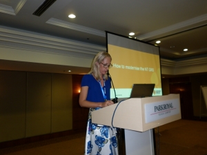
- Mrs Amy Peterson – Senior Surveyor NT Government of Australia,
DIPL Land Information Survey, Australia
Session - The Role of Organisations and Sectors
Outline – In this session presenters provided an overview of their
organisation and how they can support the geospatial and geodetic
infrastructure in the region.
Presenters –
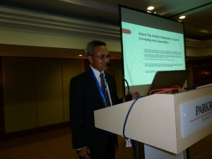
- Mr. Hj Mohammad Azmi bin Hj Mohd Zin - ASEAN Flag
- Dr John Dawson – UN-GGIM-AP WG1 Chair
- Mr Rob Sarib - FIG AP CDN Chair
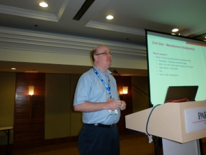
- Mr Neil Ashcroft – Manufacturers and Commercial Sector
Workshop – Modernising Regional Geospatial / Geodetic
Infrastructure
Outline – The purpose of this interactive session was for
participants to identify, analyse and prioritise challenges for Region /
Countries; explore solutions for the challenges; and discuss and
strategize the way forward.
Facilitators – Dr. John Dawson UN-GGIM-AP WG -1 and Mr Robert Sarib
FIG AP CDN
Presenter –
- Mr. Villiami Folau, Pacific Geospatial Surveying Council, Tonga
As previously mentioned, the forum was conducted in an atmosphere of
respectfulness which resulted in open and honest discussions from
participants. Many common regional challenges were identified and
possible strategies were considered. A summary matrix of these
workings was formed and is outlined below.
|
Issue / Challenge
|
Specific Problem
|
Strategy to Mitigate
|
|
Data Sharing
Data charging versus “open” / “free” data policy
Data infrastructure vs data service delivery
|
Sharing of data limited resulting in non-optimum outcomes
National legislation /regulation / policy hinders sharing
|
Preparation of an pro-forma data agreement to assist with setting up agreements
Establishing a forum for discussion, exchange of ideas
Encourage participation in common regional / sub regional cause or driver such as APREF
Focus the need on broader objectives / perspectives so as to articulate the importance of data sharing
Political “will” is an important factor and needs to be addressed and obtained
Examine the “parameters” / caveats surrounding data sharing and then discuss
Refer to international standards as a means e.g RINEX / SINEX
|
|
Technical capability
|
Lack of technical expertise is impeding geodetic infrastructure
|
Consider using or creating a data centre in the region
More workshops on implementation
Opportunities to be trained at agencies that have the experience (noting - funding is an issue)
Engage better with academic institutions
Develop a regional training framework based on “standards”, specifications, guidelines
Explore opportunities with private sector to provide training (noting funding is an issue)
Raising awareness of geospatial in primary / secondary educational curriculum
Develop a mechanism for short term attachments, internships on specific projects / disciplines (noting funding is an issue)
Use the network of professional surveyors
Use the national requirements for CPD to develop knowledge on geodesy / geospatial
|
|
Implementing change (modernisation)
|
Lack expertise in developing change programs impeding geodetic infrastructure (communicating change)
|
Legislate or mandate geodetic aspects
Ensure the technical issues are communicated / implemented before implementation occurs
|
|
Resourcing
Human + financial
|
Lack of expertise impeding implementation of geodetic infrastructure
Maintenance of infrastructure and systems
Ongoing justification of budgetary support
|
Scholarships specific to geodesy / geospatial from donor or development agencies / partners
Forums with prospective donor or development agencies /partners to understand their process
Advocate / promote the need / value for geodetic / geospatial infrastructure at national / regional / global levels and its importance to
society and the economy
|
|
Legislation and policy
|
Absence of legislation and policies impede implementation of datums
Security of data clauses within legislation / regulations
Modernisation of legislation (digital info)
|
Examine the issues / challenges from a regional perspective
Prepare a proposal regarding legal requirements and compliance
|
|
Regional unifications
|
Lack of data sharing and standards impede unification
Duplication of infrastructure and data custodianship
Interoperability / integration of data and systems
|
More advocacy on standards, and guidelines; the benefits of application and adherence.
|
|
Business models
|
Roles / Responsibilities of government and private sector changing and is unclear thus leading to indecision and possible duplication and
wastage of resources
|
Understand the options – share experiences.
More inclusion and discussion amongst the various sectors
|
|
Communication infrastructure
|
Unreliable or lack of communication Impeding geospatial / geodetic infrastructure opportunities
Regulations re frequency “spectrum” can be an issue
|
Share knowledge experiences to manage this challenge
Engage with more telecommunication operators
|
|
Academic surveying institutions not providing relevant or quality courses
|
Impedes sustainability of infrastructure and operations
|
Engage with relevant institutions
Consider partnerships / programs with academic institutions
More collaboration amongst academic agencies
|
|
Decision makers not understanding the importance / value of geospatial / geodetic infrastructure
This also applies to the “society” understanding our value.
|
Lack of political will and suitable “champions” to advocate the value of geospatial / geodetic infrastructure
|
Promote the social, economic benefits / importance (disaster / saving lives) at the national / regional level
Articulating the cause and the effect scenarios
“Top down and bottom up” approach.
Try to get interest / involvement at the Ministerial level – think like them?
Innovate ways to get their attention - do not focus just on the technical but alternative social / economic “drivers”
Information and awareness campaigns at all levels of government / public / society and make it LOUD.
|
|
Attracting more young professionals to surveying
|
Succession planning
Sustaining the integrity of the infrastructure.
|
Have a “geodetic” open day!
AtAttend careers workshops.
|
The forum concluded with participants recognising that each country
in the region is at different phases of development with respect to
Geospatial and GNSS CORS infrastructure and systems. It was also
acknowledged that despite this the challenges being experienced or
resolved by a country are not new or unfamiliar, and that a common and
collaborative strategy to overcome these was to share knowledge,
information and experiences. As a consequence, FIG AP CDN
and UN-GGIM-AP WG1 agreed to facilitate meetings, workshops or forums in
2017 to confront priority challenges and to continue building the
capacity of geospatial scientists and surveyors in the region.
Presently, the UN-GGIM-AP WG1 work plan for 2017 will comprise of
workshops in–
- Kobe, Japan, 29-30 July 2017 in conjunction with the IAG-IASPEI
Joint Scientific Assembly;
- Kamamoto, Japan in conjunction with the UN-GGIM-AP Plenary
Meeting, October 2017;
- China, September 2017.
Please note, the FIG AP CDN will also endeavour to be involved in the
above capacity building activities, and in conjunction with the
UN-GGIM-AP WG 1, continue to provide technical support to the Pacific
Geospatial and Surveying Council (PGSC).
In addition, a resolution based on the activities of the subject
forum was compiled by FIG AP CDN and UN-GGIM-AP WG1. This
resolution was then tabled at the Fifth Plenary Meeting of the Regional
Committee UN-GGIM-AP, and was unanimously accepted and endorsed by the
members.
The Geodetic Reference Frame resolution was as follows -
The Meeting,
Reaffirming that the Global Geodetic Reference Frame underpins
satellite positioning technology, provides the framework for all
geospatial activity and is a key enabler of spatial data
interoperability, disaster risk reduction, land management, and supports
sustainable development,
Recognizing the General Assembly Resolution (A/RES/69/266)
on the Global Geodetic Reference Frame for Sustainable Development,
Recognizing also the importance of data sharing to enable
global and regional products and services to be related to individual
countries to support decision makers to address social and environmental
issues such as rapid urbanisation, sustainable development, disaster
management, and complex crustal dynamics,
Noting the challenges of building technical capacity in the
Asia Pacific region to modernise national geospatial and geodetic
infrastructure, in particular GNSS CORS densification, geodetic datum
determination, unification of height systems, and integration and
interoperability of fundamental datasets,
Noting further the challenges of sustaining geospatial and
geodetic infrastructure with respect to accessing reliable
communications, obtaining and justifying resources, and modernising
relevant legislation, policies, and practices particularly in the
context of the administering geospatial and geodetic data,
Noting further the lack of awareness of the value and
importance of geospatial and geodetic infrastructure amongst some
sectors of government, industry and the wider community,
Noting further the present limited availability of qualified
young geodetic surveyors in the region,
Recommends that the Regional Committee of United Nations
Global Geospatial Information Management for Asia and the Pacific
(UN-GGIM-AP):
- Support geodetic experts to attend appropriate regional forums,
such as the UN-GGIM-AP Working Group 1 meetings;
- Engage in multilateral collaboration to facilitate the exchange
of information, knowledge and experiences so as to address the
geospatial and geodetic infrastructure and system challenges;
- Adopt the International Terrestrial Reference Frame (ITRF) by
participating in regional geodetic programmes such as the
Asia-Pacific Regional Reference Frame (APREF) and the Asia Pacific
Regional Geodetic Project (APRGP);
- Share geospatial and geodetic data openly and freely to support
for example the connection of national datums to global systems so
that decision makers can address global and regional issues such as
sea level change through the use of global and regional products and
services;
- Consider sharing real-time geodetic observations to support
disaster risk reduction including tsunami warning;
- Proactively participate in communication and outreach activities
to raise the profile of geodesy as a service to society;
- Engage with the relevant academic community to review and
implement appropriate courses of study or curriculum to be aligned
with the modern requirements for operational geodetic or geospatial
scientists;
- Advocate promote and communicate the value and importance of
geospatial and geodetic infrastructure and information to decision
makers, governments, industry, and wider community;
- Provide opportunities to develop technical knowledge through
internships and short term attachment programs for geodetic and
geospatial scientists;
- Evaluate and modernise legal and institutional arrangements
pertaining to administering geospatial and geodetic data and
infrastructure;
- Encourage and facilitate technical capability development
through training, workshops, and cooperation in GNSS CORS
densification, GNSS data processing, geodetic datum and geoid
determination, geodetic datum transformations, geospatial data
integration and interoperability, and the use of open geodetic
software and the sharing of best practice examples and use cases;
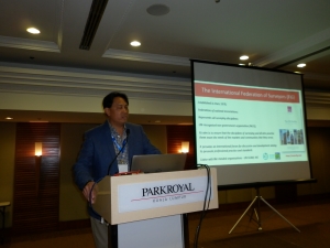
- Work closely with the International Federation of Surveyors
(FIG), in particular the FIG Asia Pacific Capacity Development
Network (AP-CDN), the Pacific Geospatial and Surveying Council
(PGSC), the International Association of Geodesy (IAG) and other
relevant organisations to develop geodetic capability in the Asia
Pacific.
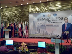
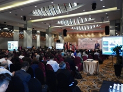
FIG Asia Pacific Capacity Development Network Report on

Upon completion of the Geospatial and GNSS CORS Infrastructure and
Systems forum, the 5th UN GGIM AP Plenary Meeting, and the forum on
Policy and Legal Frameworks for Geospatial Information Management were
convened at the same venue, the Park Royal, Kuala Lumpur. In
addition, two other events ran in parallel and they were the Social
Tenure Domain Model (STDM) and Fit-For-Purpose workshop, and the 4th
Divisional Meeting of the United Nations Group of Experts on
Geographical Names (UNGEGN) - Asia South East (ASE). Altogether,
these events over the period 17 – 20 October attracted 495 delegates
from 29 countries and consisted of 125 international attendees.
To view the proceedings please refer to the web location and select
the appropriate presentation materials -
http://ggim.un.org/Kuala%20Lumpur%20Forum.html
Like most UN-GGIM-AP events opportunity was provided to participants
to discuss and question the presentations and their findings. As a
result a “declaration” relating to policy and legal frameworks for
geospatial information, and several “resolutions” from UN GGIM AP
working groups were subsequently prepared, tabled and endorsed at the UN
GGIM AP Plenary Meeting. Please refer to the following web
location
http://ggim.un.org/Kuala%20Lumpur%20Forum.html for the link to
the Kuala Lumpur Declaration and to web location
http://www.un-ggim-ap.org/
for the various UN-GGIM-AP Working Group Resolutions.
The key messages to note from the UN-GGIM-AP Plenary and Policy and
Legal Frameworks forum sessions were–
- Open data policies for geospatial information need to be support
by standards and best practices
- Legal and regulatory frameworks for unmanned aerial and
vehicular systems need to be flexible but also address issues such
as safety, privacy, welfare and economics
- The need for governments to find the right balance between the
rights of privacy, data protection and the need to access
geospatial data and information
- Existing “geo-information” regulation is outdated and needs to
be modernised
- In some countries there is a need to have a legal mandate for
geospatial management
- Consider standardisation and simplification of licences and data
agreements, and the preparation of “base model legislation / policy
/ framework” for geospatial information
- Challenges need to be resolved through collaboration,
negotiation, and dialogue
- More forums are required to exchange or share knowledge and
experiences, and to discover what is happening in other regions as
well as other industries; in particular the digital communications,
mobile phone and IT sectors with respect to “data” licensing,
agreements and liability issues.
- The need for FIG Commissions, Task Forces and Networks to
co-operate more with UN-GGIM-AP working groups and be more involved
in their technical or administrative activities. That is, as
both organisational objectives are similar, FIG needs to take the
initiative and opportunity to combine resources and efforts so as to
avoid duplication.
Once again, special thanks to JUPEM (Department of Survey and
Mapping, Malaysia) for sponsoring the UN-GGIM-AP events and also being
great hosts for the entire week in Kuala Lumpur.
In concluding, with the rapid advent of urbanisation, the uptake of
disruptive technologies and the apparent increased frequency of natural
disasters in the Asia Pacific region, FIGs role in developing the
geospatial capacity to address these challenges will be important.
Although, it was evident that there is an appetite and willingness
amongst individuals and agencies to make an immediate impact, it was
generally agreed that more work is still required to obtain the
“political will” from the decision makers so as to achieve more
affirmative action.
Rob Sarib, Chair of Asia/Pacific FIG Capacity Development Network
25
October 2016