News in 2018
|
Commission 3 workshop and Annual Meeting 2017
|
27-30 November 2017, Lisbon -
Portugal
The European city of Lisbon was fabulous, as expected.
More than seventy members from five continents and from
many different countries participated. From the field of
surveying to academics and universities, expertise and Young
Surveyors.
|
 |
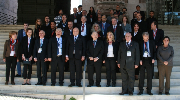
The opening ceremony that took place on 27th in the afternoon, saw
the presence of important institutional, national and international
representatives; to mention some of them:
- Seniora Célia Ramos - Secretary of State for Spatial Planning
and Nature Conservation in the Committee on Environment, Spatial
Planning, Decentralization, Local Government and Housing; /li>
- Chryssy Potsiou, President of the International Federation of
Surveyors, always present at FIG Commission 3 events with high
scientific contributions;
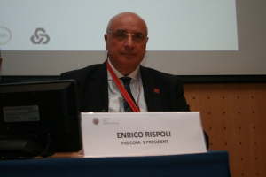
- Enrico Rispoli – President of FIG Commission 3 and Board Member
CNGeGL;
- Bob Foster, Honorary President of FIG;
- Eng. Carlos Loureiro, Vice-President of the Association of
the Ordem dos Engenheiros;
- Teresa Sà Pereira, Chair Colegio Nacional of the Ordem dos
Enghenheiros;
- Maurice Barbieri – President of the Council of European Geodetic
Surveyors;
- Nikolaos Zacharias – President of the Eurorean Group of
Surveyors.
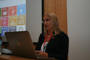 |
President Potsiou, congratulated FIG Commission 3 chair
Enrico Rispoli and Vice chair of Administration Maria Scorza, as
well as the Portuguese Engineers Association and its President
Carlos Mineiro Aires and chair Maria Tereza Sa Pereira, for
setting the themes, exploring the background and defining the
goals of the workshop and for bringing together such important
experts in the same place. She also congratulated the planners
and the organizers of this event, all the
distinguished members of both
the |
organizing and the scientific
committees for their valuable contributions. The FIG President in
her speech referred to the value of geospatial information and its
importance in implementation of the Sustainable Development Agenda by
2030. She also stated that in order to achieve this vision it will be
necessary to improve our capacity in collecting and providing the
necessary information reliably, affordably and timely, and she suggested
that crowdsourcing is a developing methodology with a potential to
support our efforts. She said that “the principle of crowdsourcing is,
apparently, that more heads are better than one, and that every person
has something of value to contribute”, and that “much of what we read
about crowd sourcing has to do with so-called ideation meaning that the
technique is applied in a search for new ideas, e.g., to support the
Sustainable Development Goals (SDGs). It is used for problem solving.
Crowdsourcing is often used in micro-tasking, that is, in breaking work
up into very small tasks and sending the work out to the crowd.”
President Potsiou clarified that “The theory is that work may be done
faster and cheaper and with fewer errors when validation systems are in
place. When used in the context of surveying the issue of validation is
critical, and assumes a certain amount of preparation and training of
volunteers as well as control of crowdsourced data prior to their
integration with official databases. It may involve the collection of
information that is required to be neither positionally nor
dimensionally precise, yet important enough to achieve the SDGs,
including cadaster and first registration where missing; and as long as
positioning and validation improve, the use of crowdsourced information
will be extended.”
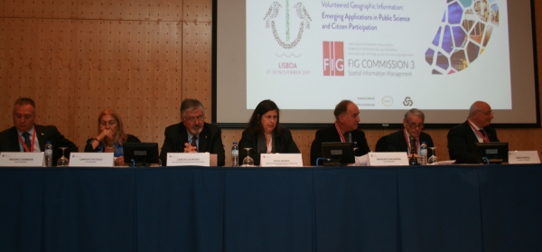
The topic proposed by Commission 3 – 2017 in Lisbon for Commission
3 Workshop “Volunteered Geographic Information: Emerging Applications in
Public Science and Citizen Participation” was a theme followed with
interest by the members who took fully part in all the sessions.
The event, this year organized by Commission 3 in cooperation with
the Ordem dos Engenheiros (the Portuguese Engineers Association) and the
EgoS European Group of Sourveyors, was full of new research and
experience on development and use of VGI, GIS, SIM, SDI, 2D/3D/4D
geospatial models, algorithms, visualization, systems and procedures.
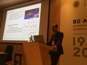
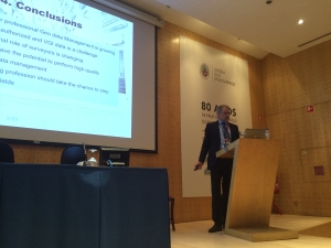
The technical sessions saw 8 Keynote Speakers and over 20 Papers (3
where peer reviews) from authors coming from Algeria, Australia,
Germany, Greece, Hungary, Indonesia, Israel, Italy, Malta, Nigeria,
Benin, Portugal, Romania, Sierra Leone, Spain, Switzerland, Turkey,
United Kingdom, USA.
These papers explained how spatial information management is having
great development, especially in relation to the ways in which
geographic and territorial data are collected, processed and
disseminated for public, commercial, historical and touristic use. All
the papers aroused the interest of important scientific journal in the
field of surveying that promoted our event and asked to publish the
proceedings. These journals are:
-
ISPRS International Journal of Geo-Information that has created
a special edition website for our event and for more information you
will find some flyers;
-
Cambridge Scholars Publishing that with the proceedings wants
to create a Manual/Book.
This year the FIG Commission 3 Workshop
elaborated better the fields where crowdsourcing is of great value for
the surveying profession in order to obtain affordable geospatial data
reliably and timely, as well as it will investigate what are the
validation systems available to the surveyor in such an operation.
VGI, another theme of the workshop, in the age of
the internet of things, is a capability and also an inescapable tool in
the present and future for better and faster geospatial knowledge and,
more than a threat for the surveyors community, it will have to be a
source for their professional activity. The integration of VGI in
Spatial Data Infrastructure (SDI) is a big challenge for our community.
The three days workshop and meeting was a great
opportunity to meet with professional and academic colleagues in the
field of surveying and to follow the reports of international members
about the latest and curious news.
As usually Commission 3 does, also this year was
elected the best paper between the peer reviews ones (many papers
deserved in the same way and over 35 participants voted) and also one
paper was chosen as
FIG
Article of the Month.
- The best paper elected was “VGI in 3D Cadastre: A Modern
Approach” by Maria Gkeli, Charalabos Iannodis and Chryssy Potsiou;
- While the paper chosen as FIG Article of the Month December
2017 was by Prof. Josè Antonio Tenedorio
“How can 3D models and augmented reality visualization based on
mobile platform enhance the value of urban heritage?”
- Many papers have received special mention for the interesting
content and also for the innovative style of illustration on the
panel.
- If you have not participated and are interested in the subject,
I suggest you to take a look at the program that is published.
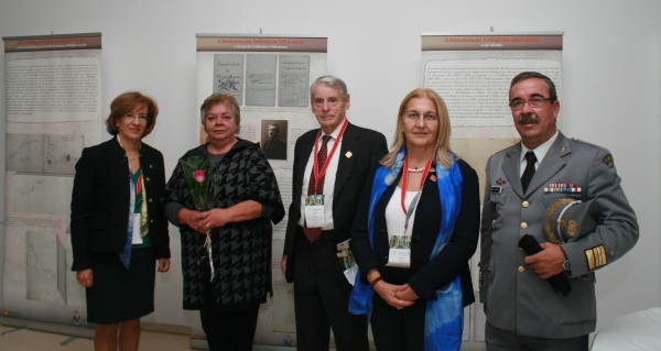
During the workshop, a very important exhibition took place for
celebrating the “150 years of the Border Treaty: military missions of
sovereignty and border representations”.
The exhibition, which was presented at the end of the Opening
Ceremony, was very interesting and was about the history of demarcation
of boundaries of Spain and Portugal: “With a centuries-old border dating
to the Treaty of Alcanices (1297), Portugal and Spain began to more
rigorously define and demarcate their border in the middle of the
nineteenth century. The efforts involved Army officers, who always led,
on the Portuguese side, the technical delegations established by the
Ministry of Foreign Affairs. Initially comprising only two
representatives of each country, the Commission expanded over time. Even
today, the Centro de Informação Geoespacial do Exército [Army Center of
Geospatial Information] continues to assume responsibility for its
maintenance in tandem with its Spanish counterpart”
The exposition was guided by Prof. Dr. Maria Helena Dias and the
President of the Army Geospacial Information Centre, Colonel José
Rodrigues.
Joining FIG Commission 3 activities in Lisbon has been an excellent
chance for increasing the international participation and this fact has
helped every participant to exchange and enhance their experiences
enabling all people to exchange new ideas and initiating new common
projects. All these will help the development of the Commission 3
activities and geodetic profession role in the society.
As a result of this important scientific event, Commission 3 expects
the presentation of numerous papers for the sessions of the upcoming
Working Week and FIG Congress which will take place on 6-11 May 2018, in
Istanbul, Turkey.
 |
As a result of this important scientific
event, Commission 3 expects the presentation of numerous papers
for the sessions of the upcoming Working Week and FIG Congress
which will take place on 6-11 May 2018, in Istanbul, Turkey.
I am looking forward to meeting you in
Istanbul.
Enrico Rispoli, Chair Commission 3
|