FIG Commission 5
|
Work Plan 2007-2010
 Original work plan in
.pdf-format.
Original work plan in
.pdf-format.
Title
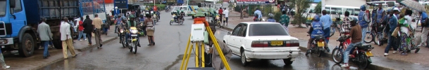
Positioning and Measurement
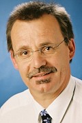 |
Mr. Rudolf Staiger, Chairperson of Commission 5 |
Terms of reference
- The science of measurement (instrumentation, methodology and guidelines)
- The acquisition of accurate and reliable survey data related to the
position, size and shape of natural and artificial features of the earth and
its environment and including variation with time.
Mission statement
- Focus on modern technologies and technical developments and assist
individual surveyors, through guidelines and recommendations, to choose and
utilise those methods, technologies and instruments that are most appropriate
to different applications.
- Follow technical developments through collaboration with other FIG
commissions and other international organisations; participation in
appropriate meetings; and the preparation of appropriate publications.
- Support research and development and stimulate new ideas in the fields of
expertise represented within the commission.
- Collaborate with manufacturers on the improvement of instrumentation and
associated software.
- Present and promote the work of the commission and its working groups on
an on-going basis at FIG working weeks and other relevant technical meetings
and in appropriate FIG and other media.
General
This work plan covers the development, use and integration of technologies
for positioning and measurement and the associated standardisation, best
practice and fundamental reference frame issues. Many of the issues are global
in nature and Commission 5, working with like-minded Sister Associations, is
well placed to deal with them. FIG Council has also asked the Commissions to
cooperate with United Nations Agencies to address global problems such as
sustainable development and humanitarian needs. The disciplines covered by
Commission 5 are at the heart of delivering solutions for the spatial aspects of
these important global problems. Specific activities aimed at developing
countries include examination of Low Cost Surveying Technologies and
contribution to appropriate Continuing Professional Development programs.
Working Group 5.1 - Standards, Quality Assurance and Calibration
Policy Issues
- Influence the development of standards affecting positioning and
measurement instruments and methods, in collaboration with the FIG task force
on standards and through participation in the relevant technical committees
(TCs) of the International Standards Organisation (ISO) and other appropriate
bodies.
- Acceptance controls, quality assurance and certification and their impact
on the surveying profession.
- Checking and calibration of measuring instruments.
- Assist other Commission Working Groups to implement Standards from ISO
TC211 as appropriate.
Chair
| |
David Martin
FRANCE
E-mail: martin[at]esrf.fr |
Specific project(s)
- Transform the existing recommendations on the Use and Calibration of EDM
(FIG-Publication 7/1994) in a digital document and make it available on the
FIG-Website
- Actualise the above mentioned EDM-Standards
- Present and promote the use of standards and guidelines to the surveying
community.
- Establish guidelines and recommendations for… (Requires updating for
relevant instruments taking into account progress during past four years).
- Guidelines and Recommendations for the ISO Guide to Uncertainty of
Measurements.
- Review Standards coming from ISO TC211 for relevance to Positioning and
Measurement.
Workshop(s)
- Participation in FIG Working Weeks and other major Commission events (see
events section below) with dedicated Technical Sessions and/or Workshops as
appropriate.
Publication(s)
- Recommendations for the Use and Calibration of EDM
- FIG Working Weeks will include Technical Papers on specific issues and
presented by Working Group Members and other invited experts
- Guidelines for… (Requires updating for relevant instruments).
Timetable
- Draft publications will be presented at FIG Working Weeks during the term
of this plan and according to a timetable to be developed by the Working Group
Chair.
- Working group final report: dedicated session, FIG Congress, 2010.
Beneficiaries
- FIG member associations, manufacturers and users of survey equipment,
governments, standardisation organisations, decision makers, GIS developers
and users, surveying businesses, individual surveyors.
Working Group 5.2 - Reference Frame in Practice
Policy issues
Policy Issues include the following:
- Work to bring together all organisations involved in defining or using
reference frames to develop common approaches and avoid duplication. Such
organisations include FIG, IAG, ISO, groups of national mapping agencies,
other influential national agencies (such as the US DoD's NIMA) and alliances
of commercial organisations (such as Open GIS Consortium and the European
Petroleum Survey Group).
- Continue the existing co-operation with IAG on AFREF as well as facilitate
similar actions on other continents as South America and ASIA.
- Provide background technical information on relevant issues written in a
way that is accessible to the surveying practitioners.
- Develop an inventory of approaches to reference frame issues in different
countries (including transformation methodologies) that is accessible to
surveying practitioners.
- Examine the concepts of dynamic and semi-dynamic datums.
- Examine how surveying practitioners are changing how they access the
reference frame, through less emphasis on networks of ground monuments and
more emphasis on Global Navigation Satellite Systems (GNSS) base stations.
- Examine global positioning services as Omnistar and the use of them for
positioning in a national reference frame
- Examine the increased use of GNSS for height determination as well as
the use of geoid models for connection to local height datums.
- Examine the role that the satellite missions GRACE, GOCE and CHAMP will
have on global geoid models
- Examine the increasing role of aerial and space based imagery in the
realisation of reference frames.
Chair
 |
Mikael Lilje
Sweden
mikael.lilje[at]lm.se |
Specific project(s)
- Initiate, contribute and facilitate meeting(s) of all organisations
involved in defining or using (regional) reference frames to develop common
approaches and avoid duplication.
- Continue development of Technical Fact Sheets that briefly explain basic
concepts, practical applications and issues and which summarise the activities
of organisations with specific responsibilities in the field.
- Ensure terminology used in above publications conform to and give
substance to the relevant Standards coming from ISO TC211. .
- Ensure that the working group web page is running and updated.
Workshop(s)
- Participation in FIG Working Weeks and other major Commission events (see
events section below) with dedicated Technical Sessions and/or Workshops as
appropriate.
- Seminars and meetings involving key organisations involved in defining or
using (regional) reference frames will be convened at a venue, time and date
to be confirmed by the Working Group Chairs.
- Symposium on Applications of Permanent GPS/GNSS Networks. WG 5.2 and WG
5.3 event.
Publication(s)
- Web page
- FIG Working Weeks will include Technical Papers on specific issues and
presented by Working Group Members and other invited experts.
- Technical Fact Sheets as outlined above.
- Working group final report will be presented at FIG Congress, 2010. .
Timetable
- Draft publications will be presented at FIG Working Weeks during the term
of this plan and according to a timetable to be developed by the Working Group
Chairs.
- Working group final report: dedicated session, FIG Congress, 2010.
Working Group 5.3 -
Integrated Positioning, Navigation and
Mapping Systems
Policy issues
While this is a new focus, it includes the topics covered by the previous
Working Groups 5.3 and 5.4 and extends to cover technology generally.
- Issues associated with ongoing and rapid developments in Integrated
Positioning, Navigation, and Mapping systems, including performance and
applications of such systems and guidelines for their use.
- Ensuring FIG input to planning associated with programs of GPS
Modernisation and GNSS Development.
Co-Chairs
| |
Andrew Hunter and Naser El-Sheimy CANADA
E-mail: ahunter[at]ucalgary.ca and
naser[at]geomatics.ucalgary.ca |
Specific project(s)
- Report on the development, possibilities and limitations of new
technologies.
- Prepare guidelines for practitioners on making the best use of systems to
achieve the results required for particular applications.
- Develop FIG input to GPS Modernisation and GNSS Development.
- Collaborate with other Commissions and other international organisations
(including IAG and ISPRS) and with equipment, software and service providers.
- Continue commitment to relevant inter-disciplinary events including the
series of Symposia on Mobile Mapping (joint with IAG and ISPRS).
Workshop(s)
- Participation in FIG Working Weeks and other major Commission events with
dedicated Technical Sessions and/or Workshops as appropriate.
Publication(s)
- Guidelines on making the best use of emerging systems.
Timetable
- Draft publications will be presented at FIG Working Weeks during the term
of this plan and according to a timetable to be developed by the Working Group
Chair.
Beneficiaries
- FIG member associations, manufacturers and users of survey equipment,
governments, standardisation organisations, decision makers, GIS developers
and users, surveying businesses, individual surveyors.
Working Group 5.4 - GNSS - Global Navigation Satellite Systems
Policy issues
- Cooperation with all organisation involved in the field of GNSS e.g. IAG
and ISO
- Keeping contact to GNSS receiver and equipment manufactures to provide
state-of-the-art information to the users
- Cooperation with Commisions 3, 4, 6 and 8 regarding GNSS integration
into GIS respectively GNSS for disaster risk management as well as GNNS
applicatiosn in hydrography and engineering surveys
- Providing technical GNSS background information on relevant issues for
surveying practioners by web-page, tutorials and workshops
- Development of recommendations regarding procedures to check GNSS
equipment
- Contribute to FIG input to GPS modernisation and GNSS development
- Prepare the surveying profession for GNSS-mass-markets (e.g. Location
based services, traffic applications,…) as well as required technologies
(e.g. assisted GPS, car navigation technology,..)
Chair
 |
Dr.-Ing.habil. Volker Schwieger
GERMANY
E-mail:
volker.schwieger[at]iagb.uni-stuttgart.de |
Specific project(s)
Special Study Groups
- Special Study Group 5.4.1 Cost-effective GNSS
- Analysis of current “low-cost” GNSS markets (e.g. LBS, traffic)
including additional necessary technologies like e.g. odometers, mobile
phones
- Recommendations for surveyors to infiltrate these markets
- Development of methods to use “low-cost” GPS for precise applications
- Report on cost-effective GNSS
- Special Study Group 5.4.2 GNSS networks (together with WG 5.2)
- Analysis and review of GNSS network technologies for practioners
- Analysis of the importance of site calibrations of permanent networks
- Analyse and compare different commercial and non-commercial GNSS networks
- Organise Workshops(s) on GNSS networks
- Special Study Group 5.4.3 Precise GNSS
- Develop and publish methods for GNSS heighting
- Develop and publish investigations regarding the GNSS/tacheometer
combinations
- Contact with GNSS equipment manufacturers
- Provide newest technical background information to the practioners
- Develop of input for GPS modernisation and GNSS development
- Special Study Group 5.4.4 GNSS calibration and check (together with WG
5.1)
- Development of procedures and recommendations for the check of GPS
equipment
- Recommendations for the calibration of GPS antennas and permanent GPS
sites
- Cooperation with standard organisations (IS0,…)
- Organisation of scientific workshops and tutorials for practioners
- Discussion with GNSS equipment manufacturers about procedures
Workshop(s)
- Participation in FIG Working Weeks, Regional Conferences as well as
other major commission 5 events in special technical sessions
- GNSS tutorials (fundamentals and practise relevant information, possibly
including practical training) e.g. at Working Weeks and Regional Conferences
in cooperation with local organizers, especially for “surveying practioners”
- International Workshop on GNSS for practitioner (engineering geodesy
companies, state survey, cadastral administration,..) together with all WGs
of Commission 5)
- Specialised International Workshops on GNSS calibration (antenna, site,
multipath) and on GNSS networks (together with WG 5.2)
Publication(s)
- Technical Papers at Working Weeks, Regional Conferences and Commission 5
Symposia and Workshops
- Recommendations for Calibration of GPS antennas and Check of GPS
Measurement Systems (together with WG 5.1 and further institutions like e.g.
ISO
- Report on possibilities of cost-effective GNSS techniques for developing
countries
Timetable
Report and recommendations should be presented (and published) on next FIG
Congress 2010
Co-operation with Sister Associations
Commission 5 is committed to cooperation with Sister Associations, especially
those with which FIG has a Memorandum of Understanding. Commission 5 has
specific liaison interest with the International Association of Geodesy (IAG)
and the International Society for Photogrammetry and Remote Sensing (ISPRS). The
Commission 5 Steering Committee will ensure that Working Group activities and
Commission 5 events further these goals of cooperation with Sister Associations.
10 March 2007


