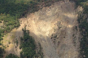
Landslides, debris flows and rockfalls can endanger inhabitants and
infrastructures. If we focus on landslides, they have an important
societal impact in many mountainous, hilly and coastal regions in the
world. Landslide failures may seriously damage the human and environmental
resources of a region. However, it is still uneasy to forecast the
evolution of a landslide because it depends both on its dynamics and on
external triggering events, such as earthquakes and rainfall. This is why
monitoring is essential to learn more on the physical processes
controlling their movement (failure, propagation) and to attempt to
predict their behaviour in time and space. Innovative investigation,
monitoring and mapping techniques are being developed in order to improve
the methods for local and regional landslide hazard assessment and/or the
design of early warning systems.
WG6.2’s main goals will be to support specialists in landslides
monitoring studies with state-ofthe art solutions and provide latest
developments and future oriented concepts:
Promoting studies on the potential of existing and new sensors to
determine geometric deformation quantities from surveying and adjacent
fields (remote sensing, seismology, meteorology, hydrology and
geochemistry);
Promoting the development of concepts for automated data storage,
data transfer and data pre-processing;
Promoting the adaptation of numerical algorithms to derive
relevant deformation quantities in real-time, including concepts from
time series analysis;
Promoting a multidisciplinary collaboration between surveying,
geological, geophysical and geotechnical engineers to understand the
behaviour of landslides;
Study of most modern concepts for data analysis like artificial
neural networks, fuzzy logics and generic algorithms;
Investigate and adopt as required modern analysis techniques (Big
Data, IoT, etc.) to cope with large volume data arising from large
number of low-cost sensors;
Study the issues and investigate the challenges arising for using
Unmanned Arial Vehicles (UAVs) for deformation monitoring;
Chair
Associate Prof. Dr. Gilbert Ferhat,
France gilbert.ferhat[at]unistra.fr
What we are working on -
FIG publication on landslides monitoring by surveying
methods