News in 2013

|
Third Session of the United Nations
Committee of Experts on Global Geospatial Information Management
24 – 27 July 2013, Cambridge, United Kingdom
On 26 July 2013, the global geospatial information
community celebrated the second anniversary of the United Nations initiative
on Global Geospatial Information Management. Two years ago, “ECOSOC made
history in Geneva by establishing a new intergovernmental body to address an
emerging global issue. The United Nations Committee of Experts on Global
Geospatial Information Management would bring together, for the first time
at the global level, government experts from all member states to consult on
the rapidly new changing field of geospatial information. At a time when few
new intergovernmental bodies are being created, this decision reflected
ECOSOC’s concern for promoting greater and wider use of geospatial
information globally for sustainable development and humanitarian
assistance” (2 August 2011, New York, UN DESA Press Release)
|

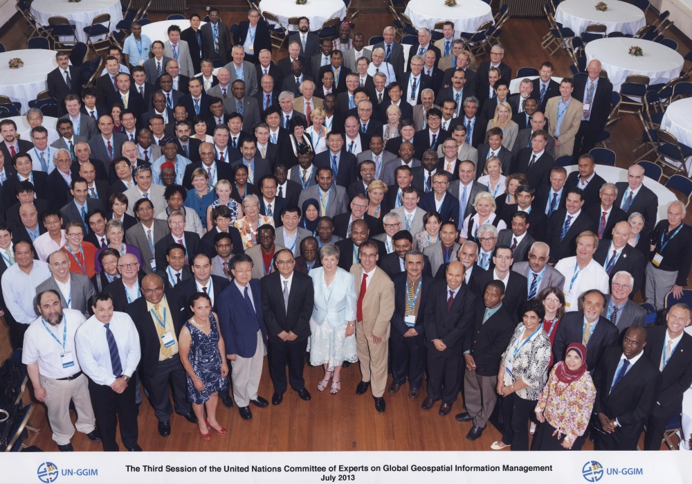
Participants at United Nations Committee of Experts on GGIM
(Photo: Courtesy of UN-GGIM/Ordnance Survey) |
This UN Committee was established to provide a forum for
coordination and dialogue among Member States and between Member States and
relevant international organizations, of which FIG is one, on all issues
related to geospatial information management. It aims to promote and develop
common policies, methods, mechanism and code of practice globally and to
enhance the interoperability of geospatial data and services. The terms of
reference approved by the Economic and Social Council (ECOSOC) of the United
Nations call upon Member States to designate experts with specific knowledge
drawn from the interrelated fields of surveying, geography, cartography and
mapping, remote sensing, land/sea and geographic information systems and
environmental protection.
The UNGGIM Secretariat and Ordnance Survey of the United
Kingdom collaborated and hosted this third session in Cambridge, United
Kingdom at the Corn Exchange in Cambridge City Centre. The event was held in
conjunction with the Cambridge Conference, the international meeting of
chief executives from national mapping organisations around the world that
was organized and hosted by Ordnance Survey. First held in 1928, the
Conference is now held biennially (since 2003) and afforded tremendous
opportunities for surveyors with similar roles from different places to
meet, exchange ideas and share experiences.
The FIG President was joined and supported by
Mr. Gordon Johnston, Vice Chair of FIG Commission 4 at this third
session. The final report on ‘Future trends in geospatial information
management: the five to ten year vision’ prepared by the United Kingdom in
collaboration with the Working Group on Future Trends in Geospatial
Information Management was endorsed. The Committee agreed that the document
is a “living document” and will need to be regularly revisited, reviewed and
revised.
There was on the agenda item on global geodetic reference
frame, and the Regional Committee of United Nations Global Geospatial
Information Management for Asia and the Pacific (UN-GGIM-AP) in
collaboration with the International Association of Geodesy tabled a report
that called for the enhancing of commitment to improve national
infrastructure and contributions to strengthen regional and global geodetic
reference frame. There were engaging discussions and the Committee agreed
that a working group would work on and facilitate the submission of a
resolution to the 2013-14 Session of the United Nations General Assembly to
seek support and commitment at the highest level to sustain the global
geodetic reference frame.
The Committee also considered the trends in national
institutional arrangements in geospatial information management; developing
a global map for sustainable development; legal and policy frameworks,
including critical issues related to authoritative data; establishing and
implementing standards for the global geospatial information community. A
report of the Secretary-General in collaboration with the International
Organization for Standardization Technical Committee 211 (ISO/TC 211) on
establishing and implementing standards for the global geospatial
information community was tabled and the importance of adopting and
implementing standards within national legal and policy framework was
emphasized.
In the discussion on linking geospatial information to
statistics and other data, primarily social, economic and environmental
data, FIG is heartened as it has worked over the past many years on
spatially enabling societies that culminated with FIG Publication number 58.
Spatially enabling societies recognizes that all activities and events have
a geographical and temporal context, make decisions and organize their
affairs through the effective and efficient use of spatial data, information
and services. Spatial enablement is the ability to add location to almost
all existing information, unlocks the wealth of existing knowledge about
social, economic and environmental matters, and can play a vital role in
understanding and addressing the many challenges that we face in an
increasingly complex and interconnected world.
The committee considered the report of the
Secretary-General prepared in collaboration with the International
Hydrographic Organization (IHO) and FIG on critical issues relating to the
integration of land and marine geospatial information. FIG had earlier
provided a background paper that was prepared with the support and
contribution of Mikael Lilje (Chair FIG Commission 5) and Jerry
Mills (Vice Chair FIG Commission 4). At the ensuing deliberations, FIG
urged the Committee and their respective governments to avail resources to
address key technical challenges within its jurisdiction as well as to
consider a working party of experts from within the Committee to identify,
share and promote good policies, standards, infrastructures and practices
that already exist in some jurisdictions. With the discovery and sharing of
such good policies and practices, it is hoped that the global community can
begin realizing the benefits and returns in the integration land and marine
geospatial information.
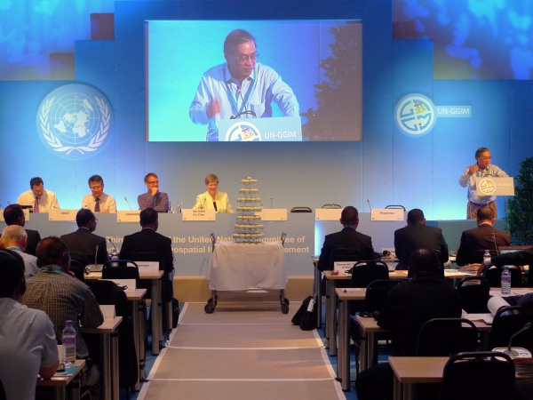
From left to right: Greg Scott (UNGGIM Secretariat); Kyoung-soo Eom (UN
Cartographic Section); Stefan Schweinfest (UN Statistics Division); Dr
Vanessa Lawrence and Prof. Paul Cheung
FIG again weighed in on the ongoing deliberations
regarding the proposal to develop a statement of shared principles for the
geospatial information community. FIG is of the opinion that whereas
cultures, political systems, awareness and understanding of professional
practice differ from jurisdiction to jurisdiction, there are certain
fundamental principles that should apply to all. FIG is supportive of a
consultative process and urged the Committee to work towards an
internationally agreed Statement of Shared Principles on Geospatial
Information Management.
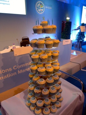 |
Dr Vanessa Lawrence, CEO of Ordnance Survey and Co-chair of the
Committee of Experts since its inception in 2011, organized a
second-anniversary celebration, with a tiered “cake” comprising a
series of cup cakes with the GGIM logo. This was much to the
surprise of the Committee and well received by those present. Prof. Paul Cheung, the Chair of the Intergovernmental Steering
Committee on Global Mapping (ISCGM) spoke during the celebration.
Prof. Cheung was the Director of the UN Statistic Division then and
had worked with the international geospatial community over a number
of years and a series of preparatory meetings to realise this United
Nations initiative on global geospatial information management. |
CheeHai Teo
July 2013
|