News in 2013

|
The United Nations
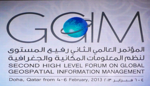
Second High Level Forum on Global Geospatial Information
Management
Doha, State of Qatar, 3-6 February 2013
The Forum was staged pursuant to the mandate from the United Nations
Economic and Social Council (ECOSOC) to convene global forums to promote
comprehensive dialogue on global geospatial information management with all
relevant governments, non-governmental organizations and the private sector.
The Forum provides member states and stakeholders the unique opportunity to
share and learn from each other to support local, regional and global
sustainable development initiatives.
The United Nations initiative on Global Geospatial Information Management
(UN-GGIM) aims at playing a leading role in setting the agenda for the
development of global geospatial information and to promote its use to
address key global challenges.
The Forum was hosted by the Qatar Statistics Authority at the recently
constructed Qatar National Convention Centre in Doha. It was co-organized by
the Secretariat of the United Nations Committee on Global Geospatial
Information Management, UN Statistics Division, UN Department of Economic
and Social Affairs. The Second High Level Forum was presided by Sheikh
Hamad Bin Jabor Bin Jassim Al Thani, President of the Qatar Statistics
Authority, State of Qatar.
The Forum was officially opened by the Prime Minister of Qatar,
H.E.
Sheikh Hamad Bin Jassim Bin Jabr Al-Thani who observed that the Forum
came at a time when countries and regions are facing societal,
environmental, economical and political challenges that impact national and
global development and growth. H.E. observed that the use of
information linked to location is instrumental in addressing these
challenges.
|
 |
Five sessions followed the opening session. The opening session included
a video address by Mr Hongbo Wu (Under Secretary General for United
Nations Economic and Social Affairs) and addresses by Sheikh Hamad Bin
Jabor Bin Jassim Al Thani, Dr. Vanessa Lawrence (Co-Chair of the
UN Committee of Experts on GGIM) and Prof William Cartwright (Chair
of the Joint Board of Geospatial Information Societies) was the Ministerial
Segment. The five sessions addressed “Building a National Geospatial
Information System: Driving Forces, Success Stories”, “Future Trends in
Geospatial Information: Growing the Information Base, Promoting Greater
Use”, “Developing an Effective Global Geodetic Reference Framework and
Supporting Location-based Services”, “Geospatial Information and Sustainable
Development (Rio +20)” and “Challenges in Developing Core Global Reference
Datasets”. The Forum issued the Doha Declaration: Advancing Global
Geospatial Information Management.
The Forum:
- affirm the importance of a stable, credible and reliable national
geospatial information infrastructure and system in each country built
on internationally recognized open standards that will federate or
integrate, manage and deliver geospatial information for timely,
evidence-based and authoritative decision making and policy formulation
to address humanitarian and developmental needs and challenges;
- resolve to work together as an international community, under the
coordination of the United Nations, to improve a sustained operational
global reference frame and infrastructure to support the increasing
demand for positioning and monitoring applications with associated
societal and economic benefits;
- promote the greater use of geospatial information in sustainable
development by supporting the activities under the programme of the
Global Map for Sustainable Development (GM4SD) with an initial focus on
natural disaster risk management to rapid urbanization and better
mitigation strategies;
- affirm the importance of an agreed set of authoritative core global
reference datasets that are needed to support global economic and
sustainable development activities including the preparation,
improvement and maintenance of these core global reference datasets; and
- collaborate and engage across disciplines and sectors including the
geospatial industry, international organization and community on the
value of place to facilitate and support informed decision-making.
The Forum was preceded by a one day Exchange Forum with the Geospatial
Industry facilitated by United Nations Cartographic Section and JBGIS with
the theme “Future Proofing the Provision of Geoinformation: Emerging
Technologies”. The Exchange Forum focused on methodologies and technologies
used to determine place, facilitate information capture, ensure
accessibility and usefulness of place-based information. This was a
pre-conference exchange that facilitated the continued involvement of the
geospatial industry at the most senior levels, discussing and demonstrating
the trends and directions the industry is heading.
The Exchange Forum concluded that future proofing the provision of
place-based information that is critical to national, regional and
international efforts and collaboration to address challenges faced by
communities and nations such as food security, climate change, rapid
urbanization and sustainable economic development, to name some, require an
international mandate on a global reference frame, strategies to demonstrate
societal and economic returns and benefits, intensify multi-disciplinary
cooperation and promoting visualization and publishing of spatially enabled
information to non-specialist users via mobile devices.
The Exchange Forum noted:
- the advancement in positioning technologies and satellite
constellations as well as the International Terrestrial Reference Frame
that allow information collected locally be shared globally and the
wider availability of precision positioning would require an
international mandate to sustain a global reference frame;
- the advances in number, types and capacities of platform and
sensors, imageries are the main source of data and the basis for
monitoring the physical environment and there remain needs for open
standards as well as strategies to demonstrate the underlying societal
and economic benefit of geospatial information as well as consideration
to address privacy issues that are context driven;
- that collaborating and communicating across disciplines using the
value of place should facilitate informed decision-making leading to
improve societies; that could be achieved by integrating authoritative
and crowd-sourced information together with place-based analysis using
the cloud platform; and
- the convergence of architecture, languages and platforms that
federate and integrate all types of information including
three-dimensional information that promote visualization and publishing
of information to non-specialist users via mobile devices support
efficiencies in society, industry and government.
The Exchange Forum recognized:
- that comprehensive place-based information underpin effective,
citizen centric delivery systems, business processes, good governance
and collaboration across jurisdictions and regions;
- that investment in the collection, connection and communication of
such data set is critical to national, regional and international
efforts and collaboration to address challenges faced by communities and
nations such as food security, climate change, rapid urbanization and
sustainable economic development; and
- that geospatial profession and industry are committed to continually
exchange ideas and practices with the wider community to further the
advancement of the Global Geospatial Information Management (GGIM)
initiative.
Cognizance and consideration should be given to the statement made by
H.E. Jean-Bertin Quedraogo, Minister of Infrastructure and Development,
Burkina Faso at the Ministerial Segment of the High Level Forum that
“specialists in the production and management of geographic information are
poorly organized in my country as it is also the case in many African
countries. People without basic knowledge on geo-information turn to be
producers of topographic maps, which results in disrespect of production
norms, the duplication of data, the lack of inter-operability of the data
coming from diverse sources. The availability of high-level human resources
to manage geographic information is therefore a major challenge”.
For additional information on UNGGIM, please refer to
http://ggim.un.org/2nd%20HLF.html
|
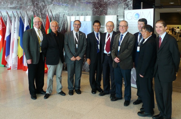
Members of the JBGIS present at the Forum took the opportunity to
have an ad-hoc meeting on the sideline of the Forum. |
CheeHai TEO
February 2013
18 March 2013
|