News in 2024

|
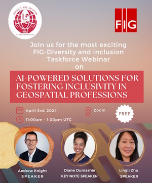
Webinar: AI-Powered Solutions for Fostering Inclusivity in Geospatial
Professions
3 April 2024 - 11-13 UTC by Zoom
FIG Task Force on the Surveyor's Profession: Evolutionary Diversity
and Inclusion invite to webinar
|
The geospatial industry is rapidly evolving, and with the
integration of Artificial Intelligence (AI), there is immense
potential to enhance diversity and inclusion.
The FIG Diversity
and Inclusion Task Force is proud to present a groundbreaking
webinar, "AI-Powered Solutions for Fostering Inclusivity in
Geospatial Professions," aimed at exploring innovative
applications of AI to promote diversity and inclusivity within
our professional community.
Join the Diversity and Inclusion Task Force Webinar:
Register here for the webinar
|
Objective
The primary objective of this webinar is to shed light on how AI
technologies can be harnessed to create a more inclusive environment in
geospatial professions. We aim to discuss and showcase AI-driven
solutions that address challenges, provide opportunities, and contribute
to a more diverse and equitable landscape.
Key Topics to be Covered:
AI in Recruitment and Talent Acquisition:
- Exploring bias mitigation algorithms in recruitment processes.
- Leveraging AI for identifying and attracting diverse talents.
Inclusive Data Representation with AI:
- Using AI to ensure diverse perspectives in geospatial data.
- Strategies for unbiased data collection and analysis.
AI-Driven Skill Development:
● Implementing AI-powered
educational tools for skill enhancement.
● Bridging the skill gap through
inclusive learning platforms.
Enhancing Workplace Inclusivity with AI:
- AI applications for promoting diversity in organizational
culture.
- Case studies of successful AI-driven inclusivity initiatives.
Interactive Panel Discussion:
- Bringing together industry experts, AI specialists, and
diversity advocates for a dynamic discussion.
- Addressing audience queries and insights on the intersection of
AI and inclusivity.
Target Audience:
- Geospatial professionals and practitioners
- AI specialists and technologists
- Diversity and inclusion advocates
- Students and educators in geospatial studies
- Employers and HR professionals in geospatial organizations
Speakers
- FIG President Diane Dumashie
- Lingli Zhu
- Andrew Knight
Dr Lingli Zhu received her doctoral and master’s degrees in the field
of Remote Sensing and Photogrammetry from Aalto University in 2015 and
2007, respectively. Currently, she is leading an AI group at the
National Land Survey of Finland. She has published around 50
publications, including more than 20 Science Citation Index (SCI)
journal papers, as the first author and contributed to three books, one
chapter of which has been downloaded more than 3,800 times. She also
served as a reviewer and guest editor for many Journals such as Remote
Sensing, IEEE Transactions on Geoscience and Remote Sensing(TGRS), ISPRS
International Journal of Geo-Information, Journal of Selected Topics in
Applied Earth Observations and Remote Sensing, and Sensors. She is
specialized in 3D modelling and feature extraction in the fields of
photogrammetry, computer vision, laser scanning, machine learning,
remote sensing and GIS.
Register for the webinar
Register here for the webinar
More
information about the Task Force
The Task Force on LinkedIn
Louise Friis-Hansen
March 2024