Vice-President Stig Enemark visits Colombia at the “Week on
Geomatics 2005”
Bogotá, Colombia, August 8-13, 2005
|
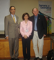
National Cadastral Director
Gabriel Martinez, Dora-Ines Ray,
FIG Vice-President Stig Enemark. |
Vice-President Stig Enemark visited Bogotá, Colombia, 8-13 August
under the celebration of the 70th Anniversary of the Agustín Codazzi
Geographic Institute, IGAC. The celebration was held as an international
event “Week on Geomatics 2005”, organized by IGAC and the Europe
Union Project: “Improvement of Colombian Cartographic Systems”.
The conference was headed by the Director General Mr. Iván Darío Gómez
Guzmán and the National Cadastral Director Gabriel Martinez, and
was organized by Mrs. Dora-Ines Ray. During the conference,
Vice-President Stig Enemark had the opportunity to discuss with these key
people about the future of the cadastre and the surveying profession in
Colombia and their role in contributing to a sustainable future.
The topics of the conference included Cadastre, Land administration,
Urban Planning, Geographic Information Systems, Spatial Data
Infrastructures, Remote Sensing, Digital Photogrammetry, Global Positioning
Systems, and Digital Cartographic Production.
The focus was on the state of the art of Geomatics and its components
presented by international and local experts, and some key persons from
principal international organizations. The purpose was to share experiences
on geographic information management, analyze trends, techniques, views,
methodologies and tools used in modern approaches.
Week on Geomatics 2005 was organized in three sessions:
- Conferences (8 to 10 August), with 348 attendees. The conferences
included 6 plenary lectures and 18 technical parallel sessions with 72
presentations. The plenary lectures were presented by high academic and
science international experts were:
- The Role of the Geographic Information in the Knowledge Society.
Milan Konecny (President of International Cartographic Association –
ICA).
- A Cadastral Tale. Stig Enemark (Vice-President of International
Federation of Surveyors, FIG).
- Digital Cartography of Soils: Towards an information System for
multiple purpose. David G. Rossiter (ITC, Netherlands).
- Trends of Photogrammetry and Geoinformation. Karsten Jacobsen
(Academic Director at the University of Hanover, Institute of
Photogrammetry and Geoinformation, Germany).
- Critical elements of a Cartographic Product Quality.
Francisco
Javier Ariza López (Professor in Cartographic, Geodesic and
Photogrammetric Engineering Department, University of Jaén, Spain).
- Cataluña Spatial Data Infrastructure (IDEC): State of the art and
challenges. José Luis Colomer Alberich (Cartographic Institute of
Cataluña).
- Theory-practice Workshops (11 to 13 August), with 121 students and
eight international expert trainers. There were 6 Theory-practical
Workshops oriented by international experts on these issues:
- Digital Elevation Models – generation, manage and analysis. Karsten
Jacobsen.
- Introduction to quality evaluation in cartography (simples and basic
controls). Francisco Ariza López and José Luis García.
- Digital Cartography of Soils: Methodological aspects. David G.
Rossiter.
- Cartographic Generalization. Karel Stanek (International
Cartographic Association - ICA).
- Maps on Web. Temenoujka Luvenoba Bandrova and Milan Konecny
(International Cartographic Association - ICA).
- Geographic Names. Juan Deguara – NGA.
- Panel on State of the Art and Cadastral trends (11 August), with 100
attendees. In the third part of the event the National Cadastre Director
from IGAC and decentralized cadastres of Colombia were invited. As key
invited was Stig Enemark, Denmark, Vice President of International
Federation of Surveyors. The principal projects on Colombian decentralized
Cadastres in the two biggest cities Bogotá and Medellín, the Colombian
National Cadastre were presented, and the vision and challenges were
discussed compared to a presentation of the National Cadastre in Denmark.
Papers and presentations will be available in the web site of IGAC and
formal proceedings will be published in Spanish in the near future.
During the closing speech the Director General of IGAC Mr. Iván Darío
Gómez Guzmán mentioned, that the participation of international experts and
key persons from important international organizations, universities and
research centres is seen as cooperative efforts that create capacity and
competence in the area of Geomatics and contribute significantly to
promoting the development of common projects.
Due to this successful event and with the objective of promoting and
strengthening the geographic information management in the country, IGAC is
committed to organize another event: Week on Geomatics 2007.
- A Cadastral Tale. Presentation by Prof. Stig Enemark, Vice President
of FIG at the Week on Geomatics 2005 in Bogotá, Colombia, 8-13 August
2005.
- The Cadastral System in Denmark. Presentation by Prof. Stig Enemark,
Vice President of FIG at the Week on Geomatics 2005 in Bogotá, Colombia,
8-13 August 2005.
|
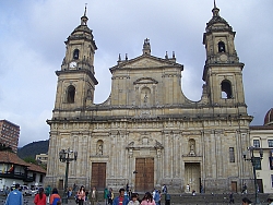
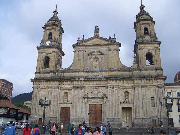
The Cathedral in Central Bogota. |
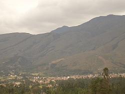
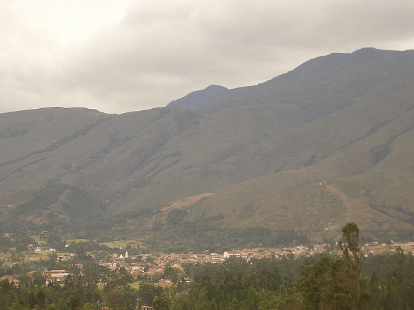
The Beautiful Colombian countryside, a view of the old colonial town
Villa de Leyva |
Prof. Stig Enemark
Vice President of FIG
September 19, 2005 |