3rd Croatian Congress
on Cadastre and 2nd INTERGEO EAST
gathers about 800 participants
Zagreb, Croatia, March 7-9, 2005
|

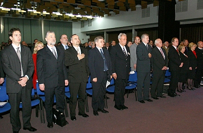
Opening ceremony of the conference. |
Vice President
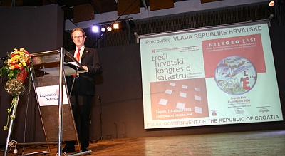
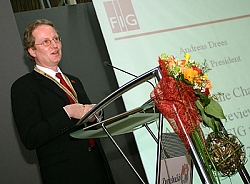
Andreas Drees making his keynote presentation |
The 3rd Croatian Congress on Cadastre with international participation
was held at the Congress Center of the Zagreb Fair in Zagreb, Croatia from 7
to 9 March 2005. The conference was held in conjunction with the 2nd
INTERGEO EAST, an international fair of geodesy, land management and
geoinformation, which took place in hall 5 of the Zagreb Fair. FIG Deputy
President Dr. Andreas Drees was invited to address the participants
of the congress on behalf of Prof. Dr. Holger Magel, FIG President,
who was not able to join. Dr. Drees gave a keynote presentation in the first
session as well.
The congress was held at a time, when the Republic of Croatia is facing
the conditions of European Union. One of the tasks that should be fulfilled
before Croatia joins the Union, is the reform of cadastre and land registry.
Croatia approaches the problem with great care: laws about state survey,
real estate cadastre, land registry and property rights have already been
passed. Within the program of state survey and real estate cadastre for the
period 2001 - 2005 the first phase of real estate cadastre, establishment of
basic geodetic networks and multipurpose spatial information systems have
been finished. The establishment of land data base started the process of
renewal of land registry.
It was the aim of the organizers of the conference, the Croatian Geodetic
Society (CGS), to attract national, regional and European professionals in
fields of cadastre, geoinformatics and land management to attend and provide
their experience and proposals for acceleration of the program realization.
This goal was well achieved when about 800 participants assembled at the
opening ceremony, coming from Croatia, the neighbouring states, whole East
Europe and Western Europe as well. Petar Micolic, President of CGS
opened the Congress and highlighted the aims of the event. After having two
Congresses on Cadastre and several other meetings on this topic with good
results, he pointed out as the main problem, that the actions of politicians
have not been that strong as expected.
Two ministers of Croatia, Minister of Justice and Minister of
Agriculture, attended the congress and expressed that they will help with
building the necessary legal framework. Hopefully they will do. It was
obvious from the following keynotes from Croatia, that there is especially
need for urban and rural land consolidation laws. It is not enough to survey
the whole country in the best manner and within short time spending more
than 200 million € from the World Bank and providing only little or no help
with appropriate land management services.
The keynote from FIG representative Dr. Drees gave an overview on current
activities of FIG in the period 2003-2006. He stressed especially the
contributions surveyors can deliver besides the classical technical
services. This was also a main topic during his short visit of the Geodetic
Faculty of the Zagreb University, where he met with several professors and
with the Dean of the Faculty with whom he discussed the necessary broad
curriculum following the current FIG definition of a surveyor.
A very important meeting of representatives from many of the neighbouring
countries was organized during the congress as well. This round table was
attended by the World Bank, FIG, CELK, Eurogeographics, GTZ, UN WPLA
representatives as well as others.
Under the chairmanship of Prof. Dr. Zeljko Bacic the round table
discussed the different experiences that the East European countries have
made in developing cadastral and land registry systems. A final
documentation of this discussion would help as a contribution to the
individual states and also to get FIG Commissions involved as well.
Congratulation to CGS and the Scientific Board under Prof. Damir Medak
who had organized a really interesting congress that included 8 technical
sessions:
- Cadastre and E-Government
- Basis of Land Data
- Land and Ownership Registries - Problem Solving
- Complex Geoinformation Systems - a Tool for Registry Development
- Croatia on the Way to EU - Contribution of Geoinformation
- New Technologies for State and Cadastral Surveys
- New Official Geodetic Datums and Cartographic Projections
- Cadastre and GIS - Practical Applications
The proceedings have been printed and are available through CGS
(unfortunately many of the presentations are only available in Croatian
language).
INTERGEO EAST attracted a lot of surveyors and offered a slightly larger
fair than the first INTERGEO EAST in Belgrade last year. This show seems to
develop to an annual event for East Europe.
Andreas Drees
Vice President of FIG
|

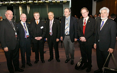
International delegates at the Intergeo East. |
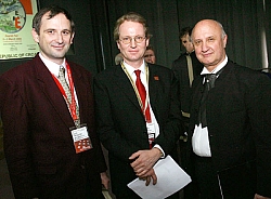
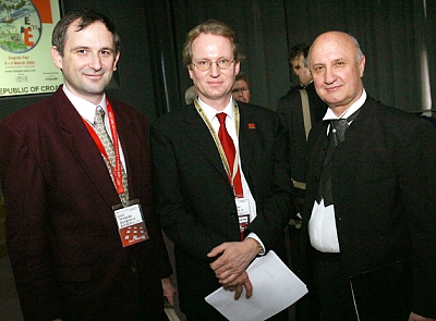
Dr. Drees with the local hosts. |
|

Dr. Drees making his presentation. |
|
March 13, 2005 |