GEOFORUM’2005 in Lviv, Ukraine, April 7-9, 2005
|

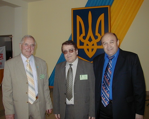
Prof.
Igor Trehovo (left), President of the Ukrainian Society of
Geodesy and Cartography together with Secretary General Stepan
Savchuk and the former Director General of the State Service of
Geodesy, Cartography and Cadastre, Anatoly Bondar. |

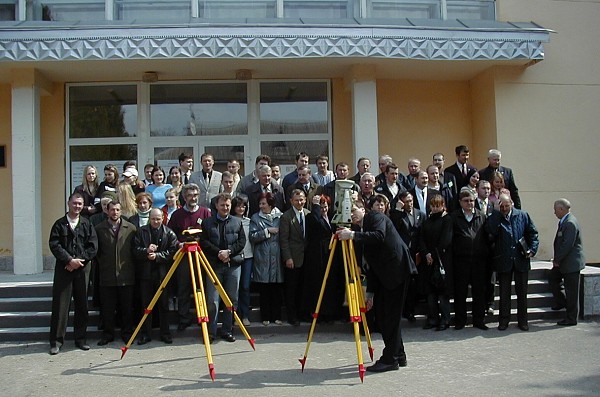
Group picture outside the meeting hall of Polygon in Ukraine.
|
The Ukrainian Society of Geodesy and Cartography organized the 10th
International Scientific Conference “Modern Progresses of Geodetic
Sciences and Industry” also known as GEOFORUM’2005 in Lviv-Yavoriv,
Ukraine 7-9 April 2005. The conference was also the celebration of the 60th
Anniversary of the Institute of Geodesy of the National University “Lviv
Polytechnic” and the 10th Anniversary of the Ukrainian Society of Geodesy
and Cartography. Traditionally this international conference is organized in
conjunction to the National Day of Geodesy and Geology held on the first
Sunday of April each year. The conference was held at the Polygon military
camp outside Lviv and it was attended by 170 geodesists and surveyors. FIG
was invited to attend the conference for the first time. The purpose of the
visit was also to discuss the co-operation between FIG and the Ukrainian
Society of Geodesy and Cartography after the society was re-organised some
years ago. The society celebrates its 10th anniversary also this year
becoming member of FIG in 1994.
The conference was organized by the Western Geodetic Society of Ukraine
and sponsored by the National University Lviv Polytechnic and State Service
of Geodesy, Cartography and Cadastre Ukraine. The Lviv Polytechnic was one
of the three universities providing education in geodesy in the former USSR
(the others being Moscow and Novosibirsk). Even today most of Ukrainian
surveyors are educated in Lviv that takes about 100 students for surveying
education every year. Some disciplines are also taught in Kiev. In Lviv the
education is joint for all students for two years after which they can
select between geodesy, photogrammetry and land management. It was positive
to see the also geodesy and photogrammetry are doing well in Ukraine and
that there are no problems in finding work after graduation (contrary to
many western European countries). The total number of surveyors in Ukraine
is about 5,000 out of which 2,000 are working in the government and 1,500
have the license to practice private companies. The current problems include
challenges to revise the legislation to fit the requirements of the EU when
Ukraine is considering to become a member of the European Union. This also
means that there is lot of work to do with the cadastre and land ownership.
The start of a big World Bank financed surveying/land management project has
been delayed from the original schedules.
The GEOFORUM’2005 was running for 3 days including plenary sessions and
parallel sessions. Most of the papers were about geodesy and photogrammetry
and only few about land administration. The quality of technical papers was
very high and many of them were of scientific character. International
contributions came from 10 countries including Russian Federation, Armenia,
Czech Republic, Slovakia, Latvia, Poland, Moldova, Germany and Israel.
The FIG Director had the opportunity – in addition to the conference – to
visit the Institute of Geodesy and have meetings with the leaders of the
Ukrainian Society of Geodesy and Cartography, its President Igor Trehovo,
Secretary General Stepan Savchuk and the former Director General of
the State Service of Geodesy, Cartography and Cadastre, Anatoly Bondar,
who brought Ukraine to FIG in 1994. In the discussions both support in
administrative issues – strengthening the status of surveyors – legislation
and joint events in the future were discussed, including the idea of having
a conference for the countries in the region that are considering to apply
the EU membership.
|
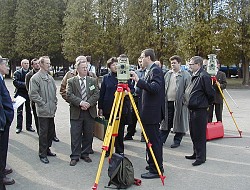
Leica demonstration in Polygon. |
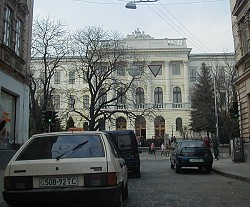
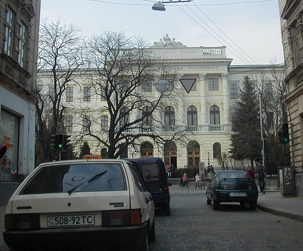
Lviv Polytechnic - the conference was linked to the 60th birthday of the
Geodetic Institute |
|

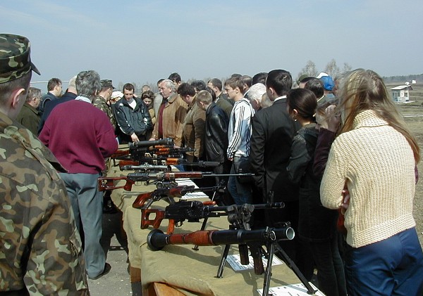
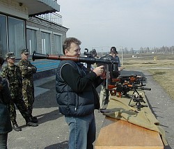
Visit to the Polygon training camp where the participants had the
opportunity to try their shooting skills. |
 |
|

Ukranian folk songs at the gala dinner. |
|
|